 |
| Granite Peak, 12,799 feet. |
My excitement grew as the departure date got closer. I was in good shape, I hadn't bought a pack of smokes in over a year, and my climbing had progressed by leaps and bounds over the summer. The climb would be a challenge for me, no doubt, but I was ready for it. It had been a difficult summer personally, and I was looking forward to some time alone and a good adventure to clear my head and consolidate the life lessons I had learned over the past few months.
I arrived in Bozeman to pleasant weather. Unfortunately, this was not the case in the mountains. There was rain, hail, and high winds in the Beartooths (Bearteeth?). The weather was "icing" me--I'd have to wait it out in Bozeman, just me and my nerves. This ended up being quite pleasant. Bozeman is a terrific town, with an eclectic mix of citizens. In fact, Bozeman may be the only place in these United States where you can drink a craft micro brew while conversing with a cattle rancher, a college professor, and a ski lift operator, and then buy a dime bag from any one of them. I had no problem relaxing while I waited for more stable weather, which was a good thing, because I had to wait for three days.
 |
| Pastoral scenes on the drive to the mountains. |
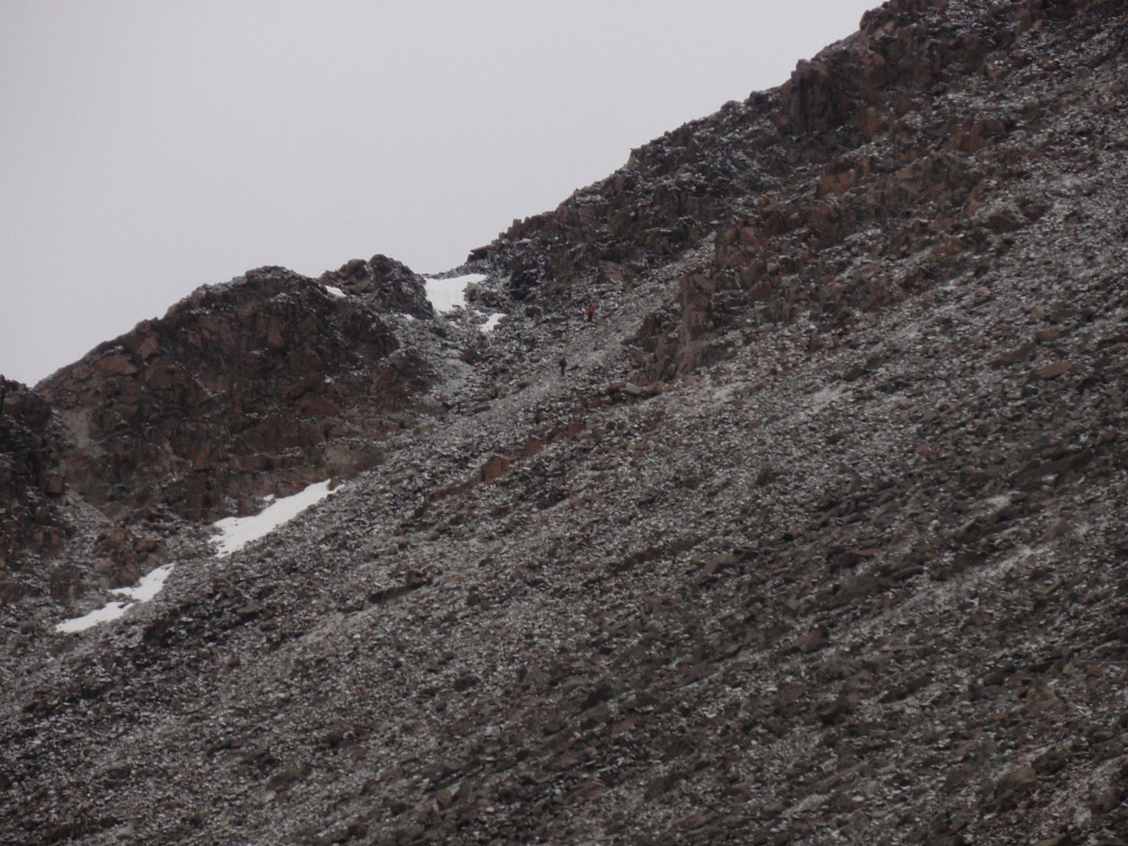
This compromise also meant that I had to carry a tent, extra food, and bivy gear. The weight took its toll as I made my way from the trailhead up to Mystic Lake and then started up the "switchbacks from hell." By the time I reached Froze-to-Death Plateau at ~10,000 feet, my legs were starting to protest. My psych also took a hit when clouds started to roll in. I had been making good time, following my bearing across the plateau, when visibility took a nosedive. Quickly, I was ensconced in a thick fog. I could see no further than 100 feet, and inevitably I got lost.
|
|


Merely following my bearing to high camp wasn't an option, as the plateau doglegged at some point along the way. I had been counting on unsubtle visual cues to inform me on the timing for the big left turn, but I wasn't able to see a stone's throw away, let alone make out peaks on the horizon. I couldn't follow cairns either. They were spaced far enough apart that I was unable to see the next one in the dense fog. So...I wandered. What should have been a three-hour trip across the plateau ended up taking closer to six. But, eventually, the fog lifted enough that I was able to discern my position. I arrived at my planned bivy site at the base of Tempest Mountain just as it was getting dark...and starting to hail.
In the gloaming, I set up my tent, cooked dinner, and admired the fortitude of the mountain goats. It takes a hearty animal to lick the salt out of a fresh puddle of piss. When I settled down for the evening, the hail was not yet falling fast enough to really accumulate. But the longer I lay awake in my tent, kept up by the marmots gnawing on my tent poles, the harder it fell. I wondered what the climbing on the south face would be like with ice-covered rock. I don't remember if the hail had stopped by the time I fell asleep, around 3 am.
 |
| Icy talus field between Tempest Mountain and Granite. |
I managed to pick my way across the icy talus without incident, arriving at the saddle in good time. I now had an intimidating view of the east ridge that rose up to buttress the mountain and provide a path to the south face. It looked much larger from this angle than it had from my camp site, and I knew that climbing it in icy conditions would be mentally exhausting. Luckily for me, although my body may be frail, my brain is like a big dumb mule, gluttonous for punishment.
I lost track of the time it took to ascend the ridgeline, but it seemed interminable. My progress was slow, and I made mistakes. Instead of committing to either the crest or the base of the ridge and sticking to my line, I wandered back and forth in a vain attempt to find the "perfect" path of least resistance. This added time, I'm sure, but it was also frustrating. I was increasing the vertical distance I had to cover every time I dropped down from the crest and then scrambled back up again after poor route finding left me cliffed out or caught up amongst large boulders. Finally, after making my way down to the base of the ridge yet again, I was able to access a snowfield that led up to the end of the ridge and my next obstacle, the much ballyhooed snowbridge.
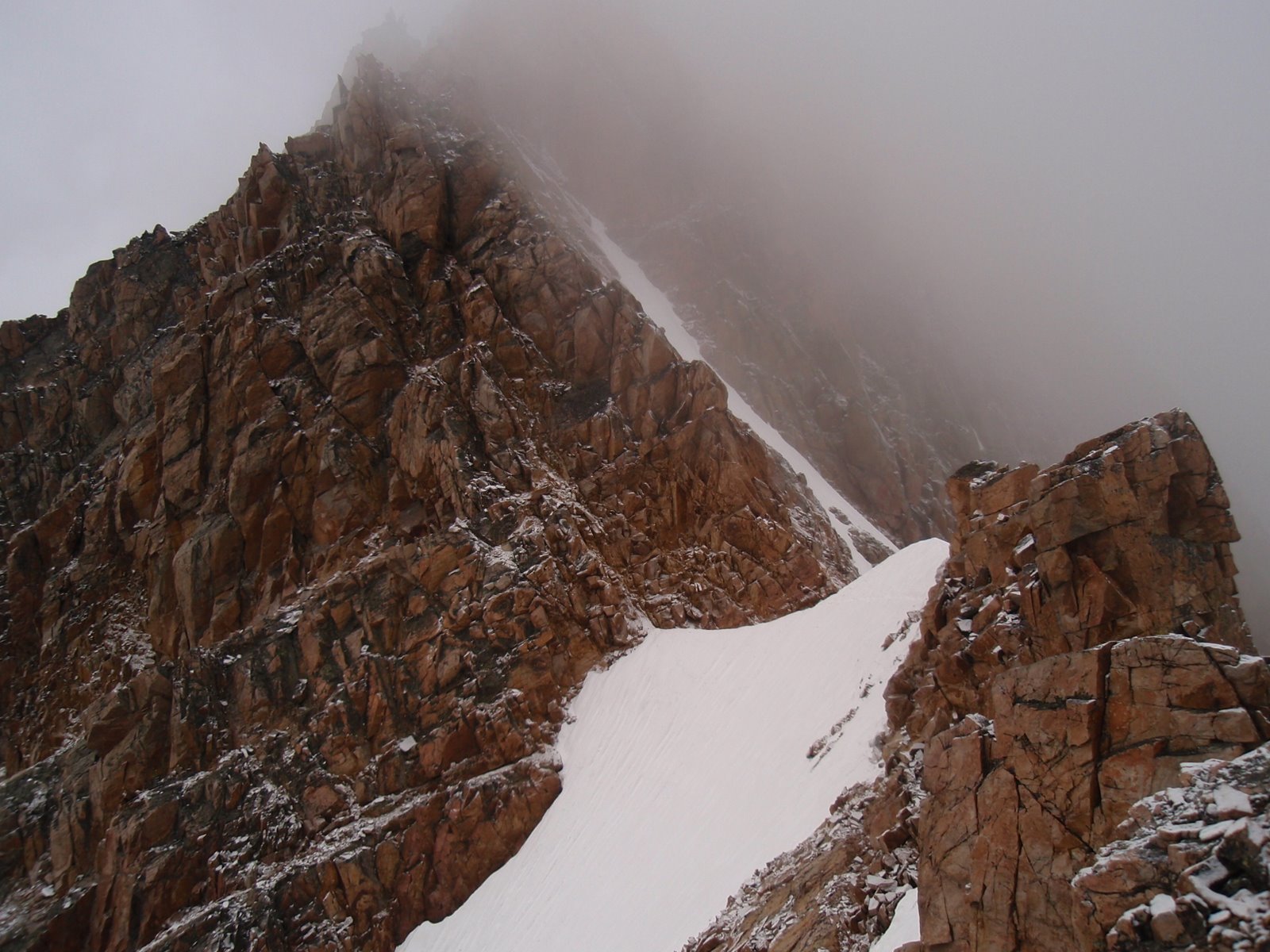 |
| The snowbridge, as I encountered it in early August. |
August is the most popular month to climb Granite. In addition to the relatively stable weather, it is also the most likely time of year for the snowbridge to be found emasculated from lack of snow. I had hoped for this very scenario, but alas, it wasn't to be. A deep snowpack that winter had left an unusually virile layer of white stuff to negotiate. Being alone and without crampons, I actually considered self belaying as I made my way to the east side of the bridge. But when I got up close, I could see that the snow conditions were good. I had an ice axe, and kicking steps was relatively easy. I felt in control crossing the bridge, and it passed without incident.
I stashed my ski pole, extra water, and ice axe, which would soon prove to be a mistake, and prepared to take on the system of chimneys that would finally put me on the south face. From what I had read, route finding truly becomes an issue here. The chimney system is, at its easiest, fourth class. However, this only holds true if you never stray from the easiest route. But, as anyone who has ever been on a mountain knows, the "established" route is never as easy to find as it would seem when you're looking at pictures on your home computer. Scale is often a big part of the problem, as it was for me at that moment on Granite. Everything looked massive in person. Is that a chimney in front of me or an elevator shaft? Is that the "x" crack feature that marks the start of the fourth class? In pictures I had judged it to be the size of a television, but in real life it looked roughly the size of a helicopter landing pad.
Moreover, I had been counting on the sun to emerge at some point and melt off the ice. It hadn't, and in fact things were getting more grim. Clouds had settled in and visibility was low. I was the only person on the mountain at that point, and it started to feel a little eerie. I had no idea if weather was coming in from the west or not, as I couldn't even see the summit at that point because of the clouds. My imagination started working overtime, and I was certain that a killer summer hail storm was bearing down on me and would arrive at any moment, stranding me on the steep south face. I considered bailing, but it occurred to me that what waited for me off the mountain wasn't any more inviting -- a lonely post-breakup dating milieu and an unfulfilling career. That was the first time I had had such a depressing thought while climbing, but it wouldn't be the last. I was immediately struck with a compelling urge to have a cigarette and a glass of whiskey. I promised myself that if I made it to the top, if I didn't bail without giving it my all, that I would reward myself with a pack of smokes. I guess that did it, because I lowered my head and pressed on.
I'm not sure if I ever found the fourth class chimney system that leads to the south face. The moves I ended up pulling seemed much harder than fourth class, but then again, friction moves always feel harder on ice. I really could have used my ice axe that had been so carefully stashed at the snow bridge. In any event, after a few breathless moments, I found the south face and immediately saw the path I needed to take.
 |
| A picture of the south face taken from SummitPost. A climber is circled in red to show scale. |
The face was steep, but again the conventional wisdom promised that there wouldn't be any moves harder than 5.easy if I stuck to the proper route. The route proved to be ledgier than it seemed from below, with lots of exposed traversing. There were a few vertical steps, but rarely was there a move that was harder than 5.4 or thereabouts, even with the icy conditions. There was one interesting moment when I slipped out of an icy hand jam down onto a ledge and, to my immense horror, nearly dropped my SPOT (personal tracking unit) 2,000 feet down the south face, onto the glacier below. I was somehow talked into allowing my friends and family to track my progress online, following the real-time GPS coordinates plotted over a Google map. (NEVER AGAIN!) Had I dropped the damn SPOT, my parents would have seen an immediate and severe dip in my altitude and assumed I had fallen to my death. In that brief instant where the SPOT unit hung in the air, time slowed and I imagined my parents calling the Park Service for a body recovery. I could practically hear the rotors on the Chinook coming to short haul my broken body from its icy resting spot. Somehow, in one of those moments I'll remember clear as day for the rest of my life, I managed to snag the SPOT between my heels as it hit the narrow ledge and started to slide backwards toward infamy.
 |
| Cumbre! Summit blocks, covered in ice and heavy fog. |
When I got to my camp, I refilled my water bottles and lay down for a quick nap. Taking stock of my physical condition, I knew I could make it back to the car without too much suffering, as long as I didn't get lost. If I remember, it was roughly 2:30 when I left camp, and I had about 12 miles left to hike out. The sun had made an appearance and burned off the low clouds. There was no killer storm behind Granite Peak. Instead, I was rewarded with great views from my camp site. That also meant that I wouldn't get lost on the descent hike, as I'd have cairns to follow and clear lines of sight so I could take bearings. I set off over the plateau in good spirits.
To make a long story just a little bit longer, the descent did not go quite as planned. I did end up getting lost on the plateau once again. In my glee at being able to follow cairns instead of using my compass, I foolishly did not take any bearings. Instead, I blindly followed the cairns directly to the wrong side of the plateau, costing me roughly an hour and a half. Once I realized my mistake and corrected, dusk was approaching, and I found myself alone in grizzly country. I didn't have any bear spray on me, and my body was well seasoned with the sweet aromas of human sweat and beef jerky. Could I be any stupider? I tried to tell myself that it was no big deal. It was only August, and grizzly bears wouldn't be desperate enough to attack a human until later in the season. And besides, what were the odds of running into one anyway? Well, it wasn't long before I came across what could have only been fresh bear tracks following the trail down the switchbacks. Cautiously, I followed the tracks for about 100 yards before they veered off into the brush. As soon as I passed the point where the tracks departed the trail, I took off as fast as I could go without appearing panicked. I didn't stop looking over my shoulder until I made it past Mystic Lake and into the valley where the trailhead, and my Subaru, waited.
 |
| Jubilation! |
No comments:
Post a Comment